
Most visitors see the Seine from a bridge or a tour boat, then head back to the crowds. The better plan is to walk along the Seine itself, down on the quays, from one island to the next. This guide picks five riverside spots that most first-time visitors walk straight past, joins them into a route, and tells you which months and times of day suit each one, so the river becomes the spine of your trip rather than a backdrop.
When to Go: Japan
Blossom, autumn colour or quiet temples?
Every month across Japan rated for weather, crowds and prices, region by region, from Hokkaido to Okinawa, with a 7-day booking plan and the free 12-Month Map.
See the Japan guide · $19About 100 pages · PDF, US Letter and A4 · Digital download · All sales final
The best way to walk along the Seine in Paris is east to west, from the Jardin Tino Rossi on the left bank to the Île aux Cygnes near the Eiffel Tower. On the way, stop at the quays of Île Saint-Louis, the Square du Vert-Galant at the tip of Île de la Cité, the green bookstalls of the bouquinistes and the car-free Parc Rives de Seine. Late spring and early autumn are the most comfortable months; winter floods can close the lower quays.
✅ Key takeaways
- ✓The riverbanks between the Pont de Sully and the Pont d’Iéna are a UNESCO World Heritage site, so almost every step of a central Seine walk has something worth stopping for.
- ✓The car-free Parc Rives de Seine replaced a riverside expressway and gives you about 2.3 km of traffic-free walking on the quays.
- ✓The Square du Vert-Galant sits so low that it goes under water when the Seine rises unusually high, so it’s a calm-weather stop.
- ✓The bouquinistes run along more than three kilometres of riverbank: right bank from Pont Marie to the Quai du Louvre, left bank from the Quai de la Tournelle to the Quai Voltaire.
- ✓In summer, the city opens supervised Seine swimming sites, typically from early July to late August, including one opposite the Île aux Cygnes.
Why a Walk Along the Seine Shows You the Real Paris
The Seine is the one place where Paris’s big sights and its quiet corners sit side by side. UNESCO lists the historic stretch between the Pont de Sully and the Pont d’Iéna, including the Île de la Cité, the Île Saint-Louis and their bridges, quays and riverbanks, as a World Heritage site. Notre-Dame, the Louvre, the Grand Palais and the Eiffel Tower all line it.
When to Go: Morocco
Coast, cities, mountains or desert?
Every month across Morocco rated for heat, crowds and prices, region by region, with Ramadan and festival timing explained and a 7-day booking plan.
See the Morocco guide · $19112 pages · PDF, US Letter and A4 · Digital download · All sales final
That’s also why the upper quays get crowded. The trick is to drop down a level. The lower quays, the island tips and the stretches at either end of the centre are where the river slows down, and where Parisians come to read, eat a picnic or sit with their feet over the water.
2.3 km
of car-free quays in the Parc Rives de Seine
240
bouquinistes selling from green boxes
<1 km
length of the tree-lined Île aux Cygnes
~220 hrs
average July sunshine in Paris, the river’s brightest month
🧰 Try it while you read: a free tool for this trip
Free trip timing tool
Shoulder Season Detector
Find the months just before and after the peak: good weather, fewer people.
Loading the tool…
Walk Along the Seine: The 5 Spots at a Glance
Here’s the shortlist, ordered from east to west so you can walk it as one route or pick a single stretch.

| Spot | Where | Why stop | Best time |
|---|---|---|---|
| Jardin Tino Rossi | Quai Saint-Bernard, 5th | Open-air sculpture garden right on the river | Summer, when dancers gather |
| Île Saint-Louis quays | 4th, between the islands and the Marais | The calmest island, ringed by quiet quays | Morning, before the day crowds |
| Square du Vert-Galant | Western tip of Île de la Cité, by the Pont Neuf | A tiny park at water level, pointing downstream | Late afternoon in dry weather |
| The bouquinistes | Upper quays, both banks, around the islands | Second-hand books and prints in green boxes | Dry days, late morning onwards |
| Île aux Cygnes | West Paris, from the Pont de Bir-Hakeim | A narrow wooded island walk with a Statue of Liberty replica | Sunset, looking back towards the Eiffel Tower |
Linking them is the riverside route itself, much of it on the car-free Parc Rives de Seine. If you want the quieter side of Paris away from the water too, our guide to lesser-known places in Paris covers the neighbourhoods, passages and small museums.
Spot 1 and 2: Jardin Tino Rossi and the Quays of Île Saint-Louis
Start at the eastern end, where the river feels least like a tourist attraction. The Jardin Tino Rossi runs alongside the Seine on the Quai Saint-Bernard in the 5th arrondissement, and it doubles as an open-air sculpture museum, with works by artists including Brancusi, César and Zadkine set among the trees. In summer it’s popular with salsa dancers, which turns a walk into a show.
When to Go: Japan
Blossom, autumn colour or quiet temples?
Every month across Japan rated for weather, crowds and prices, region by region, from Hokkaido to Okinawa, with a 7-day booking plan and the free 12-Month Map.
See the Japan guide · $19About 100 pages · PDF, US Letter and A4 · Digital download · All sales final
From there, cross to the Île Saint-Louis. It’s the smaller and quieter of the two islands, once nicknamed the island of palaces for its grand private mansions, and its edges are lined with low quays where you can sit by the water. Walk the loop around the island rather than its main street: the views of Notre-Dame’s apse and the Left Bank are better from the quays, and there are far fewer people.
Spot 3 and 4: Square du Vert-Galant and the Bouquinistes
The heart of the walk is the western tip of the Île de la Cité. The Square du Vert-Galant is a small triangular park at the very point of the island, beside the Pont Neuf and below the bronze equestrian statue of Henri IV that gives it its name. It points downstream like the prow of a ship, and on a dry evening it’s one of the best places in the city to watch the light change on the river.
Climb back up to the quays and you’re among the bouquinistes, the second-hand booksellers who sell from green boxes fixed to the river parapets. There are about 240 of them using around 900 boxes, along more than three kilometres of riverbank: on the right bank from the Pont Marie to the Quai du Louvre, and on the left bank from the Quai de la Tournelle to the Quai Voltaire. Expect old books, prints, postcards and posters. Not every stall opens every day, so a dry late morning or afternoon gives you the best chance of finding plenty of them open.
Paris’s oldest bridge is right here too: the Pont Neuf, which links both banks via the tip of the island. For a romantic version of this stretch at dusk, see our romantic things to do in Paris.
When to Go: France
Choosing between spring, summer and autumn for Paris and beyond? This guide takes you through France month by month, with weather, crowds and seasonal highlights, so you can pick dates that suit long riverside walks, or whatever else brings you to France.
See When to Go: France · $19 →Digital download · All sales final
The Car-Free Banks: Parc Rives de Seine
What makes a long walk along the Seine pleasant today is the Parc Rives de Seine. It replaced what used to be the Voie Georges Pompidou, a riverside expressway, and now gives walkers, runners and cyclists about 2.3 km and 10 hectares of traffic-free quays. On the right bank it runs from the Pont Neuf to the Port de l’Arsenal; on the left bank it follows the lower quays west towards the Eiffel Tower end of the centre.
Along the way there are sports areas, pétanque pitches, a children’s climbing wall and cafés. In summer the park hosts Paris Plages, with deckchairs, parasols and activities on the quays. It’s busy then, but it’s also when the riverbanks feel most like a local park.
If you’re walking with children, Come to Paris suggests planning a riverside stretch of 2 to 4 km over two or three hours, with park stops, and visiting early in the morning or late in the afternoon to avoid the busiest hours. That’s sound advice for anyone.
Spot 5: Île aux Cygnes, the Island Almost Nobody Walks
Finish at the western end, where the crowds thin out again. The Île aux Cygnes is an artificial, tree-lined island just under 1 km long, set in the river in the west of the city, near the Eiffel Tower. A single path runs its length under the trees, from the Pont de Bir-Hakeim, known for its arcades and lamps, to a bronze replica of the Statue of Liberty at the far end.
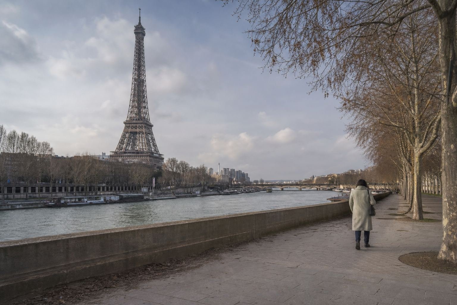
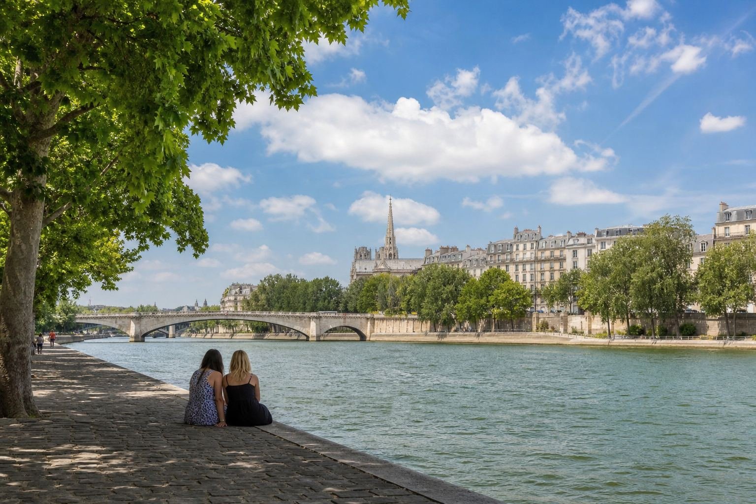
Walk it towards sunset, then turn round: the view back up the river to the Eiffel Tower is the reward. In summer, the Grenelle branch of the river opposite the island is one of the city’s supervised Seine swimming sites, so you may see swimmers in the water.

The Smart Timing Bundle
Pick the month, book in the right order, pack once
Six printable timing tools for any trip: the Trip Timing Planner, When to Book, When NOT to Go, the Shoulder Season Playbook, the family timing guide and the Packing by Season System.
See the bundle · $37Six products, $100 separately · Digital download · All sales final
The Best Time to Walk Along the Seine, Month by Month
Paris is walkable all year, but the river changes a lot with the seasons. Use this table to match your dates to the walk you want. Temperatures are long-term averages for Paris (Montsouris).
| Season | Avg high / low | Sunshine (avg per month) | What the river is like |
|---|---|---|---|
| Winter (Dec–Feb) | 8–9 °C / 3–4 °C | 57–84 hrs | Bare trees and long views; high water can close the lower quays |
| Spring (Mar–May) | 13–20 °C / 6–11 °C | 135–201 hrs | Blossom and fresh leaves; comfortable all-day walking |
| Summer (Jun–Aug) | 23–26 °C / 14–16 °C | 204–222 hrs | Paris Plages, swimming sites, busy quays, long evenings |
| Autumn (Sep–Nov) | 22 °C (Sep) to 11 °C (Nov) / 13 to 6 °C | 175 hrs (Sep) to 70 hrs (Nov) | Golden plane trees in October; days shorten fast in November |
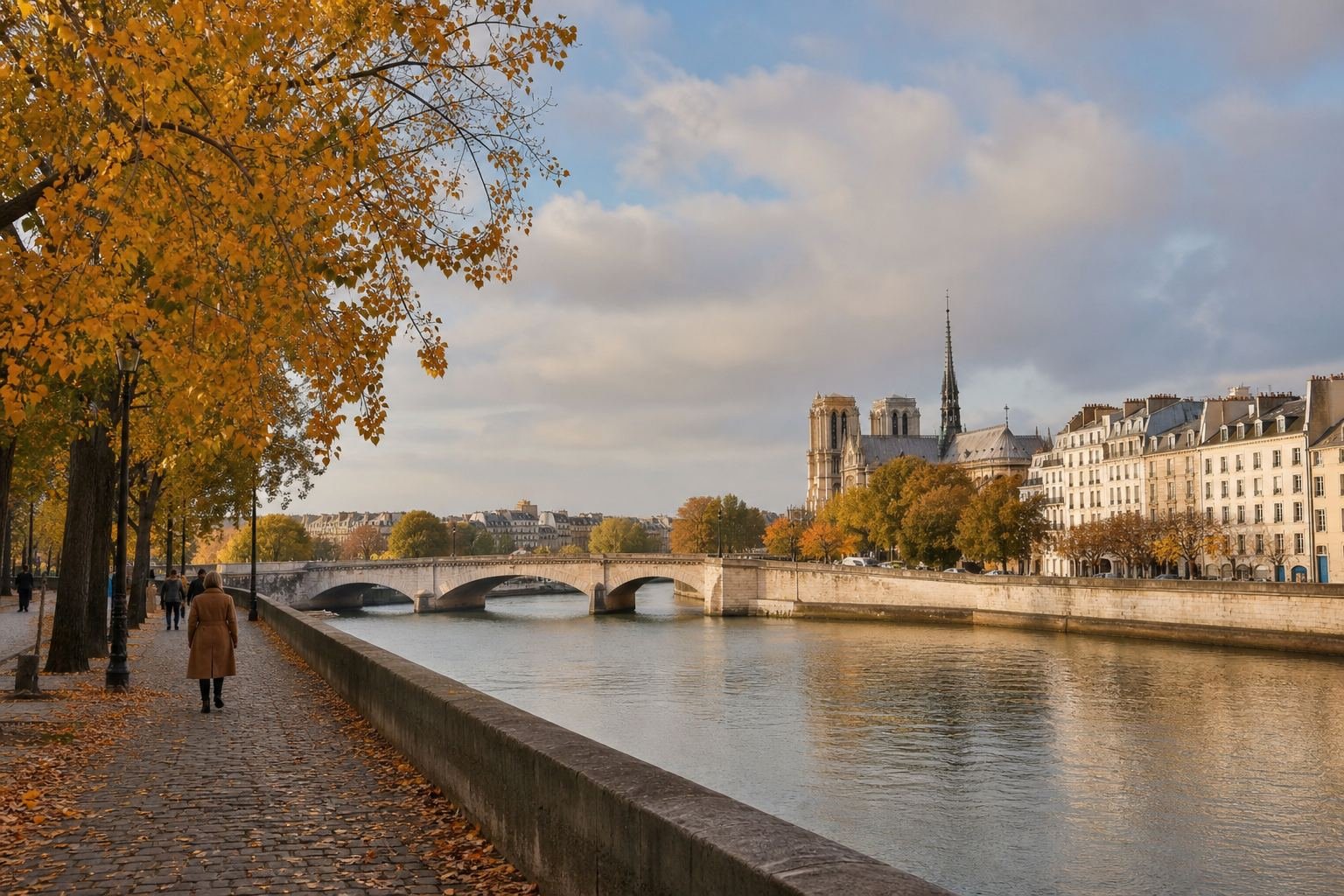
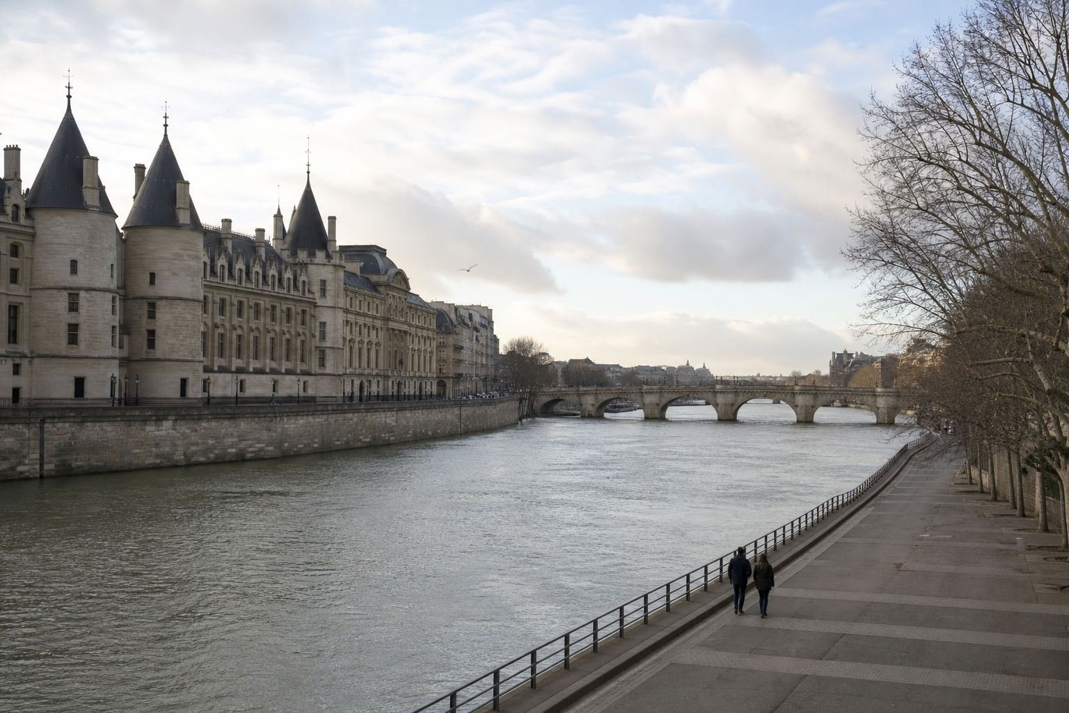
For a long walk, late May, June and September are the sweet spot: warm, bright and less crowded than July and August. October trades a little warmth for golden plane trees along the quays. Winter has its own beauty, but it’s also when the Seine is most likely to rise: during one February flood, for example, the city closed lower quays, port access and riverside roads, and advised people to keep away from low docks. A zouave statue on one pillar of the Pont de l’Alma is the classic marker Parisians use to judge how high the water is.
Want to know which month suits your trip overall? The free Best Month Finder and Shoulder Season Detector help you compare months before you book.
A One-Day Route to Walk Along the Seine, East to West
This route links all five spots. Do it in one long day with plenty of stops, or split it into two half-days: the islands in the morning, the western quays at sunset.
Morning: Jardin Tino Rossi
Start on the Quai Saint-Bernard and walk the sculpture garden by the river while it’s quiet.
Late morning: Île Saint-Louis
Cross to the island, loop its quays, and stop for ice cream or coffee.
Lunch: Île de la Cité and the Square du Vert-Galant
Walk past Notre-Dame to the western tip and picnic in the little park if the river is calm.
Afternoon: the bouquinistes and the left-bank quays
Browse the green boxes along the Quai de la Tournelle to the Quai Voltaire, then drop down to the car-free Parc Rives de Seine.
Sunset: Île aux Cygnes
Continue west to the Pont de Bir-Hakeim and walk the island to the Statue of Liberty replica, then look back at the Eiffel Tower.
Short on time? Our one-day Paris itinerary for first-timers shows how to fit a river stretch into a classic first day. After dark, continue with our ideas for things to do in Paris at night.
Drop one level down from the busy upper quays and the whole river changes: quieter, closer to the water, and very Parisian.
Common Mistakes When You Walk Along the Seine
These are the slip-ups that send people back into the crowds or leave them stuck on a closed quay.
Staying on the upper quays the whole time
The upper level has the traffic, the narrow pavements and the crowds. Take the steps down to the lower quays wherever they’re open; that’s where the river walk really happens.
Walking west to east in the afternoon
Finish in the west and you get the sunset behind the Eiffel Tower from the Île aux Cygnes. Start there, and you spend the best light at the busy centre instead.
Ignoring high water in winter and early spring
When the river is high, lower quays and low parks like the Square du Vert-Galant can close or flood. Check the river from a bridge before you go down, and keep to the upper quays if it’s high.
Expecting every bookstall to be open
Not every stall opens every day, and wet weather is the worst time to count on them. Plan the bookstall stretch for a dry day, and don’t build a whole morning around one stall.
Swimming outside the official sites
The supervised swimming sites have lifeguards, rules and daily water checks. The open river doesn’t. Only swim at the official sites, during opening hours, when the flag allows it.

The complete kit
Every country guide, every timing tool
All 24 When to Go country guides, the six Smart Timing tools and every 12-Month Map, with a Start Here that tells you what to open first.
See the kit · $127The five bundles cost $225 separately · Digital download · All sales final
Walking Along the Seine: Your Questions Answered
A walk along the Seine works best when you go down to the water, move from east to west and pick a season that suits the river you want to see. Do that and the five spots in this guide turn a famous river into your own quiet route through Paris. For more ideas, see our gardens in Paris by season, find a café for every occasion, try travelling Paris like a local, browse our France travel guides and Europe travel ideas, or plan any month from the month-by-month travel planner.
Free download
Which month for your country?
Get the free 12-Month Map: every month marked good, shoulder or avoid, region by region, on four printable pages.
- Greece to Japan, Morocco to Peru: 24 countries
- See the crowd and price peaks before you book
- Free, no purchase needed
Your download page opens as soon as you sign up. 24 countries available.